County Cavan · planning due diligence
Any Cavan site, checked in 30 seconds.
The constraints, the planning history, and the documents the council will want, before you commit a fee to a site.
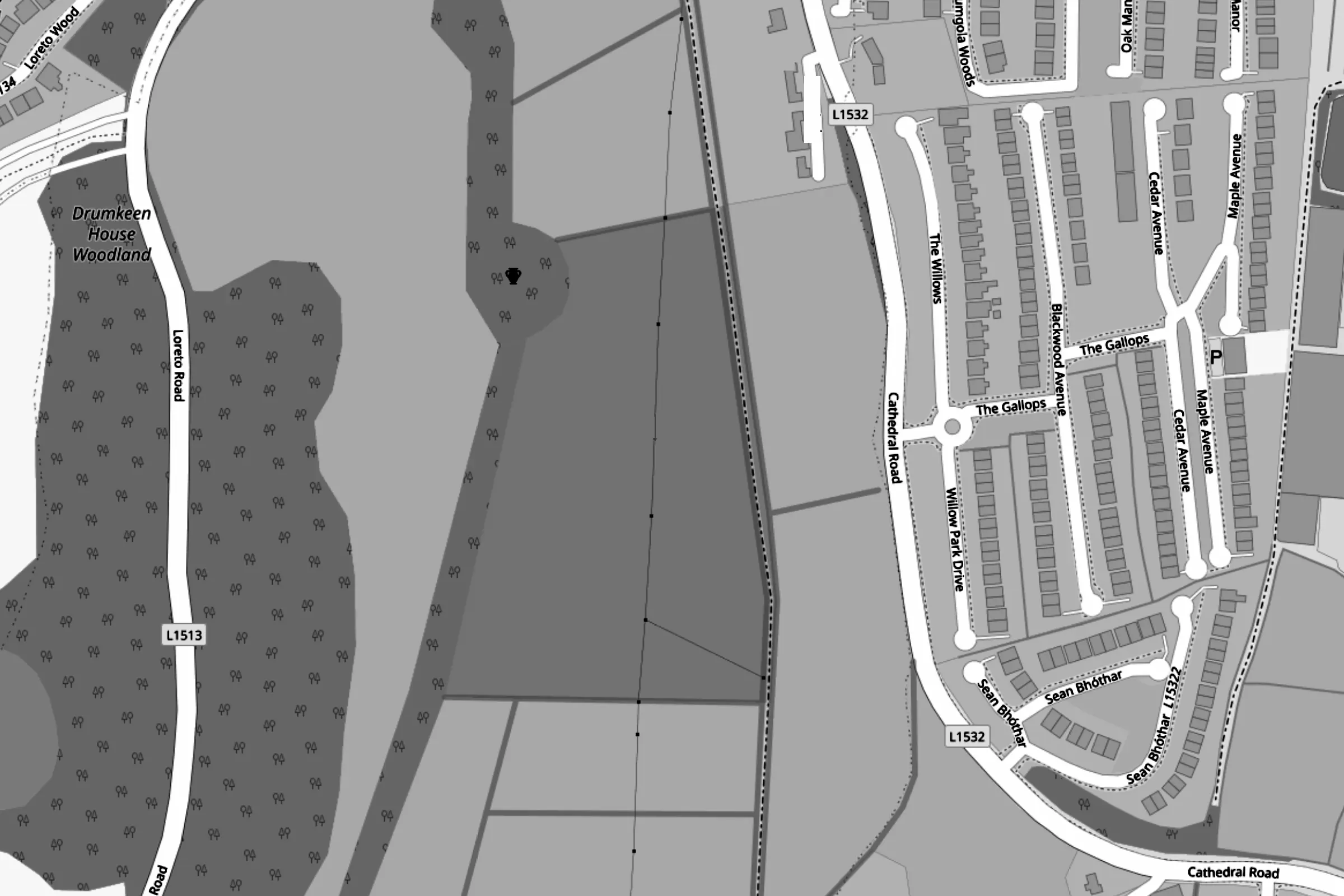 © OpenStreetMap contributors
What will shape this application
- Ringfort about 16m from the boundaryThe site is inside its Section 12 notification zone, so two months' notice is needed before works.
- Water from the site reaches Lough Oughter and Associated Loughs SAC, 5.1km downstreamAppropriate Assessment screening will be needed.
- Under 1% of the site in Flood Zone A, under 1% of the site in Flood Zone BPart of a site in a flood zone is a planning issue even where the rest is dry: a site-specific Flood Risk Assessment.
- The site spans 3 zoningsR1 67%, R4 23%, R1 1%. Expect to justify what goes on each part.
Walkthrough video coming soon
In the meantime, the demo site opens a full report on a real Cavan scheme.
How it works
- 01
Find the site
Search an address, townland or Eircode, then draw the red line or drop a pin.
- 02
Say what you're building
One line on the proposal, the number of units, and how foul water and access will work.
- 03
Get the report
Constraints, history and the documents to prepare, each with its reason, in about 30 seconds.
What you get
One report per site, in the order a planner reads it. The captures below are from the worked example, a 145-home scheme in Cavan town.
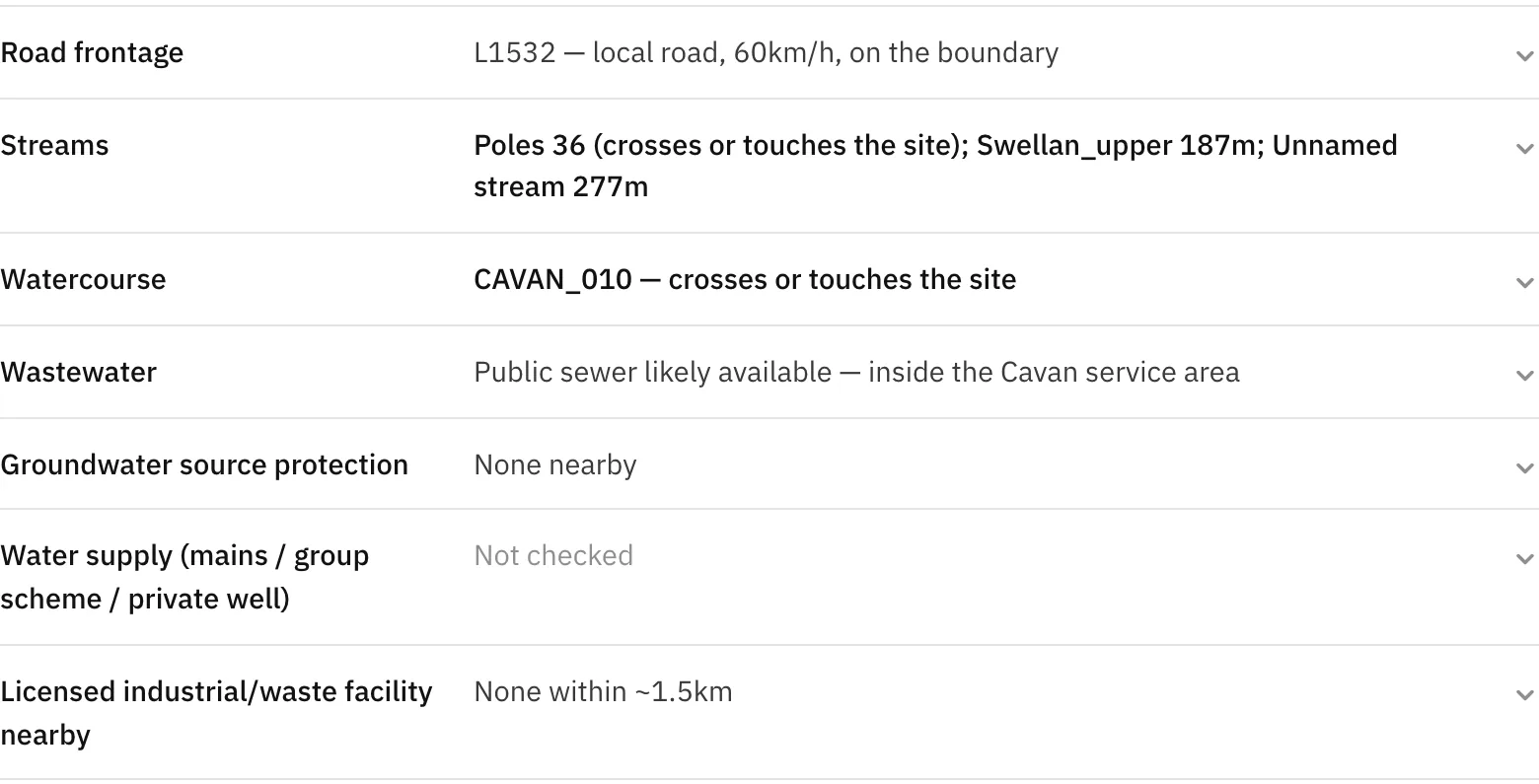
Constraints, measured from your red line
Heritage, nature designations, flood zones, rivers and streams, wastewater, ground conditions, zoning and road access. Each line says what was found and how far away, and what couldn't be checked is marked as not checked rather than guessed.
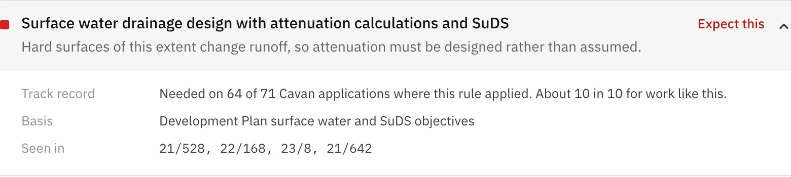
The documents the council is likely to want
Each with the reason it applies to this site, how often it was needed on comparable Cavan applications, its basis, and past Cavan references where it was lodged or asked for.
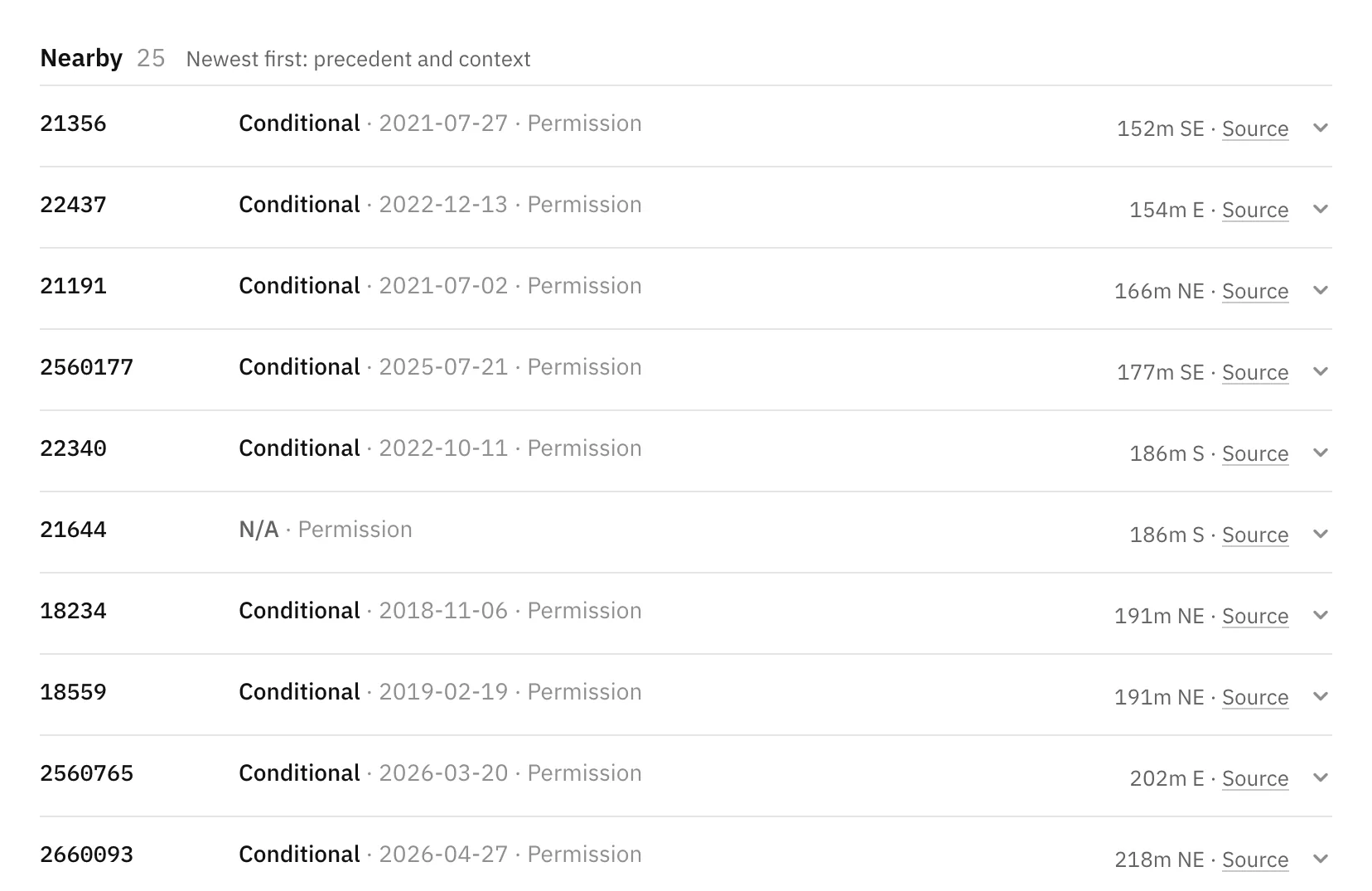
Planning history back to 1953
The council's full record, obtained under FOI: about 53,000 applications, every one on the map, with decisions, dates and distances from your site.
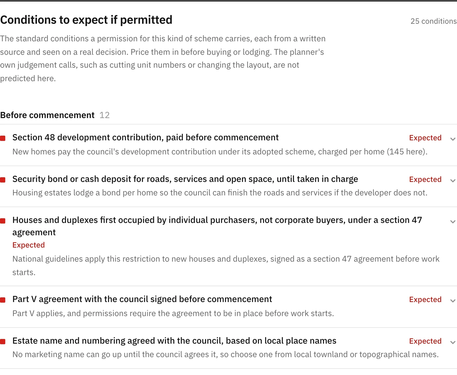
Expected conditions
The conditions Cavan attaches to permissions for this kind of scheme, grouped by when they bite, so they can be priced in before buying or lodging.
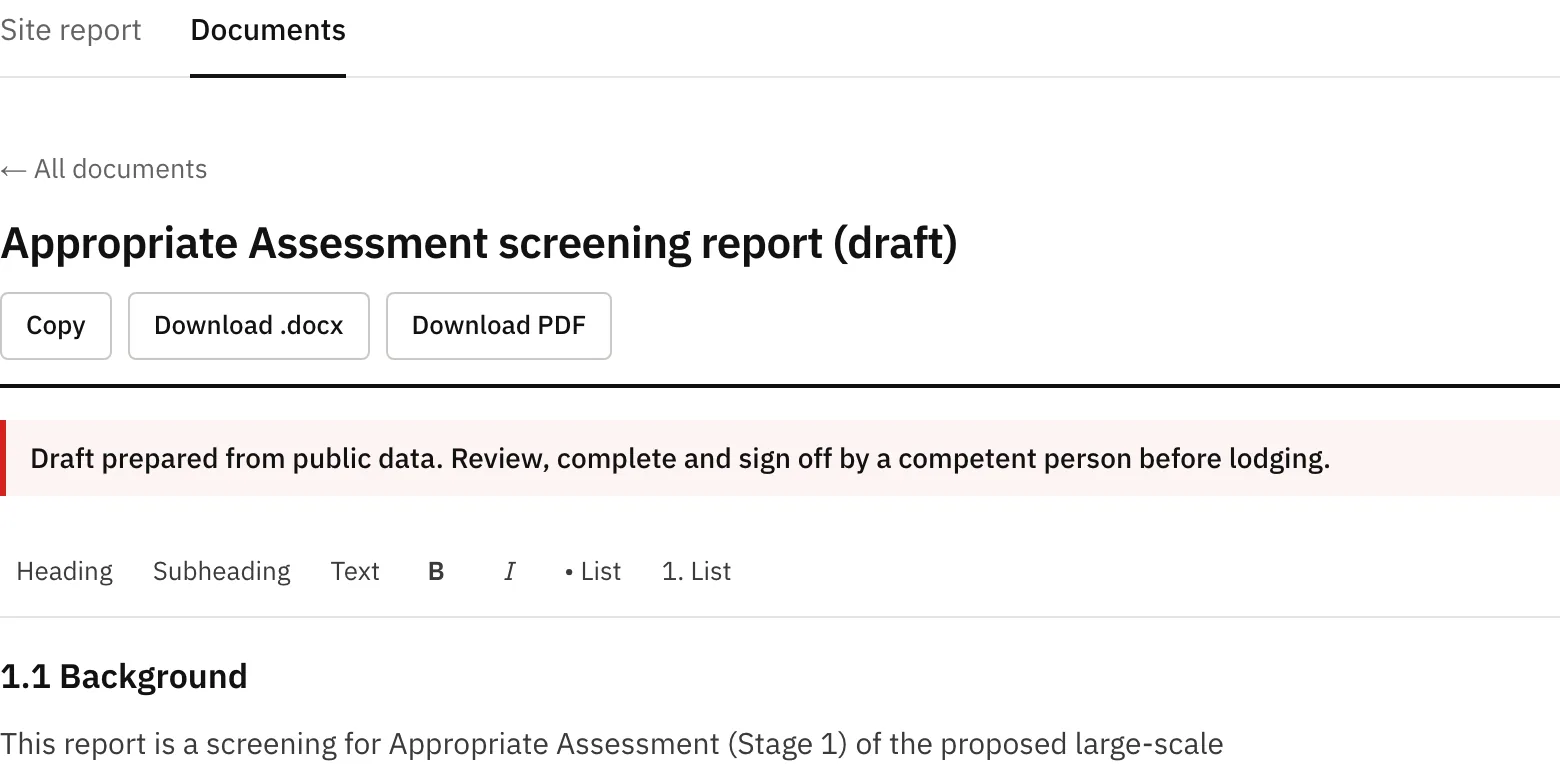
Draft documentsIn development
First drafts written from the site data, starting with the Appropriate Assessment screening report. Every draft is a starting point for a competent person to review, complete and sign.
The data it uses
Every finding comes from public datasets published by the bodies below, loaded for County Cavan. No logos: these are the sources, not partners.
Planning
Cavan County Council planning register
Cavan County Council, including its full history obtained under FOI
About 53,000 applications from 1953 to the present, every one placed on the map.
Appeal cases
An Coimisiún Pleanála (An Bord Pleanála)
Cavan appeals with the decision and the site boundary.
Cavan County Development Plan 2022–2028
Cavan County Council
The written statement and appendices, so the objectives behind each finding can be cited.
Zoning and settlement boundaries
Cavan County Council (Development Plan and Local Area Plans)
Heritage
Record of Monuments and Places and notification zones
National Monuments Service, Archaeological Survey of Ireland
Zones of archaeological potential
Cavan County Council
Record of Protected Structures
Cavan County Council
National Inventory of Architectural Heritage
Department of Housing, Local Government and Heritage
Nature
Special Areas of Conservation, Special Protection Areas, NHAs and pNHAs
National Parks and Wildlife Service
Across Cavan and 60 km beyond the county line, so downstream European sites are caught.
Freshwater pearl mussel sensitive areas
NPWS, via the EPA register of protected areas
Water
Rivers, streams and lakes
EPA river network and Water Framework Directive waterbodies
Waterbody status and risk, catchments and subcatchments
EPA (Water Framework Directive)
Wastewater agglomerations
EPA
Wastewater and water supply capacity registers
Uisce Éireann
Arterial drainage schemes, drainage districts and benefited lands
Office of Public Works
Flood Zones A and B
Cavan County Development Plan, drawn from the OPW's CFRAM flood mapping
Ground
Groundwater vulnerability, aquifers, source protection areas, karst, wells and springs
Geological Survey Ireland
Landslide susceptibility and bedrock geology
Geological Survey Ireland
Soils and parent material
Irish Soil Information System and Teagasc indicative soils, published by the EPA
Ground levels
Copernicus GLO-30 elevation model
Other
Roads and road class
OpenStreetMap
Townlands, electoral divisions and municipal districts
Tailte Éireann
Residential sales
Property Price Register (PSRA)
EPA-licensed industrial and waste facilities
EPA
How accurate it is
~70%of the documents that ended up being needed, flagged on past applications it had never seen
On about 300 past Cavan applications it had never seen, SiteIntel flagged roughly 70% of the documents that ended up being needed.
What it can't see: what's on your drawings, objections, and the planner's judgement on the day.
It's a fast first look, not a replacement for your planner or consultants.
Coverage
Cavan today. The rest of Ireland, county by county.